Stargazing
How to Read a Star Map: A Beginner's Guide (2026)
A plain-English guide to reading a star map — what the dots mean, how the grid works, why the sky in the print matches a real night, and how to spot constellations on yours.
What is a star map, exactly?
A star map is a flat printed picture of the night sky as it appeared from one specific place at one specific moment in time.
Unlike a road map, the surface a star map shows isn't horizontal — it's the dome of the sky directly above you. The center of the map represents the point straight up (the zenith), and the outer edge represents the horizon all around. So the right way to mentally orient one is to imagine yourself lying flat on your back, looking up.
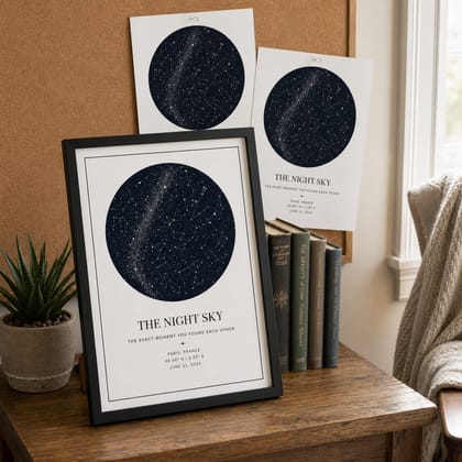
On a personalized print like the ones we make at Stars In Hands, the chart is locked to one date, one time, and one location. That trio matters: the same date from a different city would show a slightly different sky; the same place at a different hour would too. The star map you're holding records a moment that, in the truest astronomical sense, only happened once.
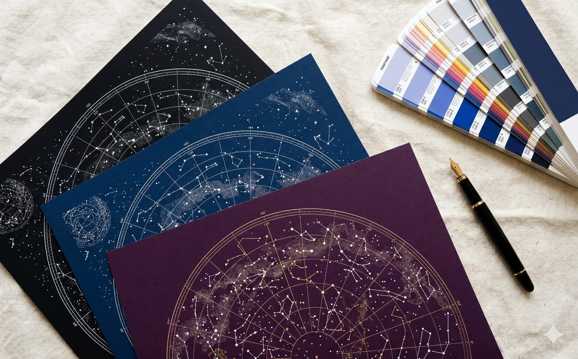
What the dots, lines, and labels actually mean
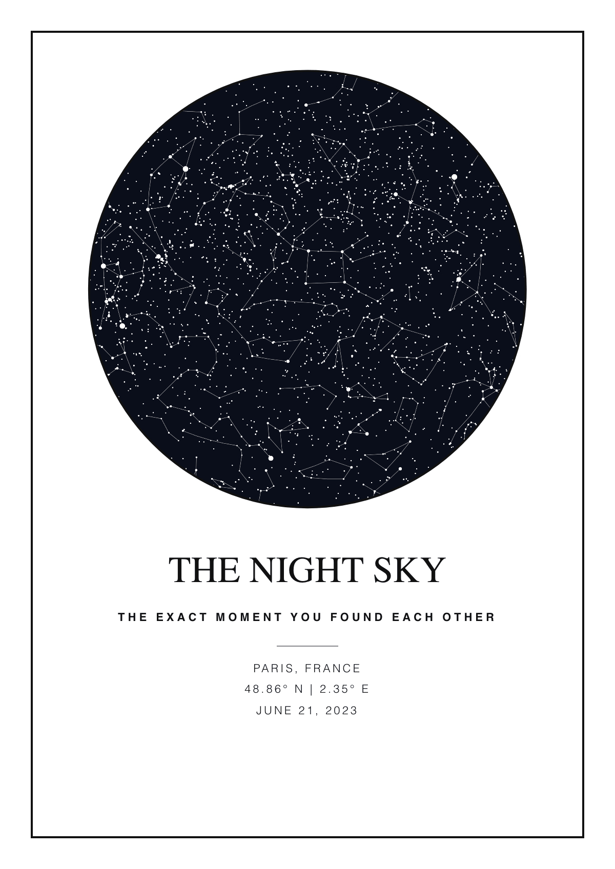
Each dot is a star, and the bigger the dot, the brighter the star — that's the only rule you really need to start reading one.
Most printed star maps show stars down to magnitude 5 or 6, which is roughly the limit of what the naked eye can see on a clear, dark night. Anything dimmer is omitted to keep the chart readable. Bright planets (Venus, Jupiter, Mars, Saturn) are sometimes drawn with a different shape or symbol if they were above the horizon at the moment captured.
The faint lines connecting some dots are constellation lines — modern astronomers added them in the 19th and 20th centuries as memory aids. The constellations themselves are much older, mostly inherited from Babylonian, Greek, and Arabic astronomy, and the boundary lines you sometimes see were standardized by the International Astronomical Union in 1930.
If your map labels coordinates, they're written as right ascension (RA) and declination (Dec). Right ascension is the celestial equivalent of longitude — measured in hours and minutes (0–24h) instead of degrees. Declination is the celestial equivalent of latitude — measured in degrees north or south of the celestial equator (-90° to +90°).
- Big dot = bright star (magnitude 1 or brighter, like Sirius, Vega, Arcturus).
- Medium dot = moderately bright (magnitude 2-3, most of the named stars in the constellations).
- Tiny dot = faint background star, only visible from a dark-sky location.
- Faint lines between dots = constellation pattern, drawn for navigation, not real connections in space.
- Dotted curve through the chart = the ecliptic (the path the Sun, Moon, and planets follow across the sky over time).
How the sky in the print matches a real night
Personalized star maps are computed from astronomical software using the same equations professional astronomers use — the print is, within a fraction of a second of arc, exactly what was overhead at that moment.
The math behind it is the standard celestial coordinate transformation. The software starts with each star's catalog position (RA + Dec from a database like the Hipparcos or Tycho-2 catalog of ~2.5 million stars), then transforms those coordinates onto the local sky as seen from your latitude, longitude, date, and time. Stars you couldn't see — because they were below the horizon, or because the Sun was up — are correctly omitted.
Two stars that are next to each other on the chart can be wildly different distances from Earth. Betelgeuse, the bright shoulder of Orion, is about 550 light-years away. Rigel, Orion's foot, is about 860. The pattern looks neat and flat from where we are because we're seeing them projected onto the same imaginary sphere — but in the real galaxy they're nowhere near each other.
The chart on your wall isn't an artist's interpretation. It is — to the best of measurable astronomy — the actual photons that left those stars between 4 and 16,000 years ago and arrived above your moment.
Design a star map for your moment
Pick a date, time, and place — see the exact sky in 60 seconds.
How to spot constellations on your star map
Find one anchor constellation first — Orion in winter or the Big Dipper in summer — and the rest become easier to navigate from there.
Orion is the easiest pattern to spot anywhere on Earth because it sits on the celestial equator (visible from both hemispheres) and its three Belt stars are nearly equally bright and equally spaced — a configuration that doesn't appear anywhere else in the sky. Once you find Orion, you can use the Belt as a pointer: extending the line up-and-right leads to Aldebaran (the eye of Taurus); extending it down-and-left leads to Sirius (the brightest star in the night sky).
The Big Dipper is the second-easiest. It's seven stars in a saucepan shape, part of the larger Ursa Major. From the Northern Hemisphere it's circumpolar — meaning it never sets — so it appears on nearly every northern star map regardless of date and time. The two stars at the end of the Dipper's bowl point directly to Polaris, the North Star.
- Find Orion (winter) or the Big Dipper (always, in the north). These are the calibration anchors.
- Note the time and date on your print — the sky on a January 4th midnight is rotated about 90° from a July 4th midnight, so the same place on the chart shows different stars.
- Trace the constellation lines if your print includes them — most personalized maps offer this as a toggle.
- Look for the brightest dot away from Orion or the Dipper. That's likely Sirius, Vega, Arcturus, Procyon, Capella, or Betelgeuse — the seven naked-eye giants of the northern sky.
- Cross-check the stars you found against a free app like Stellarium (set the same date, time, location) to confirm.
What customers ask us most
Around 70% of the questions we get about reading a Stars In Hands print are some version of these three: "why isn't my constellation labelled," "why does the sky look dimmer than I remember," and "can I make my own additional one for the same night somewhere else?"
Constellation labels are off by default on our editor because most customers prefer the cleaner aesthetic. You can toggle them on per-print in the Design tab. We support all 88 IAU constellations — the same ones a professional astronomer would use.
The sky on a print is usually a darker, deeper blue or black than what you remember from being outside, and that's intentional: light pollution from cities makes the actual visible sky much more washed out than the astronomical truth. The star map shows the sky as it would have been from a perfectly dark location — the same view from the same coordinates 200 years ago.
Frequently asked
How accurate is a personalized star map?
+
Stars In Hands prints are generated from the same astronomical data professional planetariums use — the Hipparcos and Tycho-2 catalogs covering 2.5 million stars. For any moment in the past or future within the last 6,000 years, the calculated positions are accurate to better than 1 arcsecond (1/3600th of a degree) for the brightest stars. Whatever's on your wall is, to the limit of measurable astronomy, the actual sky from that exact place at that exact moment.
Why does my star map look dark blue or black instead of like the sky I see?
+
Astronomical maps render the sky as it would appear from a location with zero light pollution — the same view your great-great-grandparents would have had from the same coordinates. The washed-out grey or orange sky most modern city dwellers see is artificial sky glow from streetlights. Showing the true astronomical sky preserves what the moment actually looked like in the universe, regardless of what was happening on the ground.
What do the lines connecting stars on a star map mean?
+
Those lines are constellation patterns — modern memory aids, drawn between stars that humans have grouped together for navigation since Babylonian times. The stars themselves aren't physically connected and are usually hundreds of light-years apart. The lines just give you a visual pattern to recognize. On a Stars In Hands print they're optional and can be toggled in the editor.
Can I read a star map without knowing astronomy?
+
Yes. The two things you need are: dot size = brightness, and the chart represents the dome of sky overhead with the horizon as the outer edge. With those two rules and one or two anchor constellations (Orion or the Big Dipper), you can navigate any star map. Apps like Stellarium let you cross-check by entering the same date and location.
Why isn't my zodiac sign visible on my star map?
+
Your zodiac sign is the constellation the Sun was in front of on the day you were born — which means it's behind the Sun and not visible at midnight on your birthday. To see your zodiac constellation, you'd look at the night sky around 6 months later (your half-birthday). For a star map of an evening, the visible constellations are the ones opposite the Sun's position on that date.
Can the same star map show two locations?
+
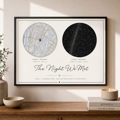
Not on a single star chart — each chart locks to one set of coordinates because the visible sky differs by latitude. But Stars In Hands offers a Combo Map that pairs two scenes side-by-side on one print: e.g. the night sky from 'where you met' next to the night sky from 'where you live now.' That's how most couples solve the two-location question.
Ready to start?
Create your personalized gift
Choose the moment, wording, colors, and finish. Preview your design in the editor before you order.
Design a star map for your momentKeep reading
How to Choose the Perfect Star Map Design (2026 Guide)
With so many shapes, palettes, and fonts, designing your star map can feel overwhelming. A structured walkthrough of the decisions that actually matter.
Read Article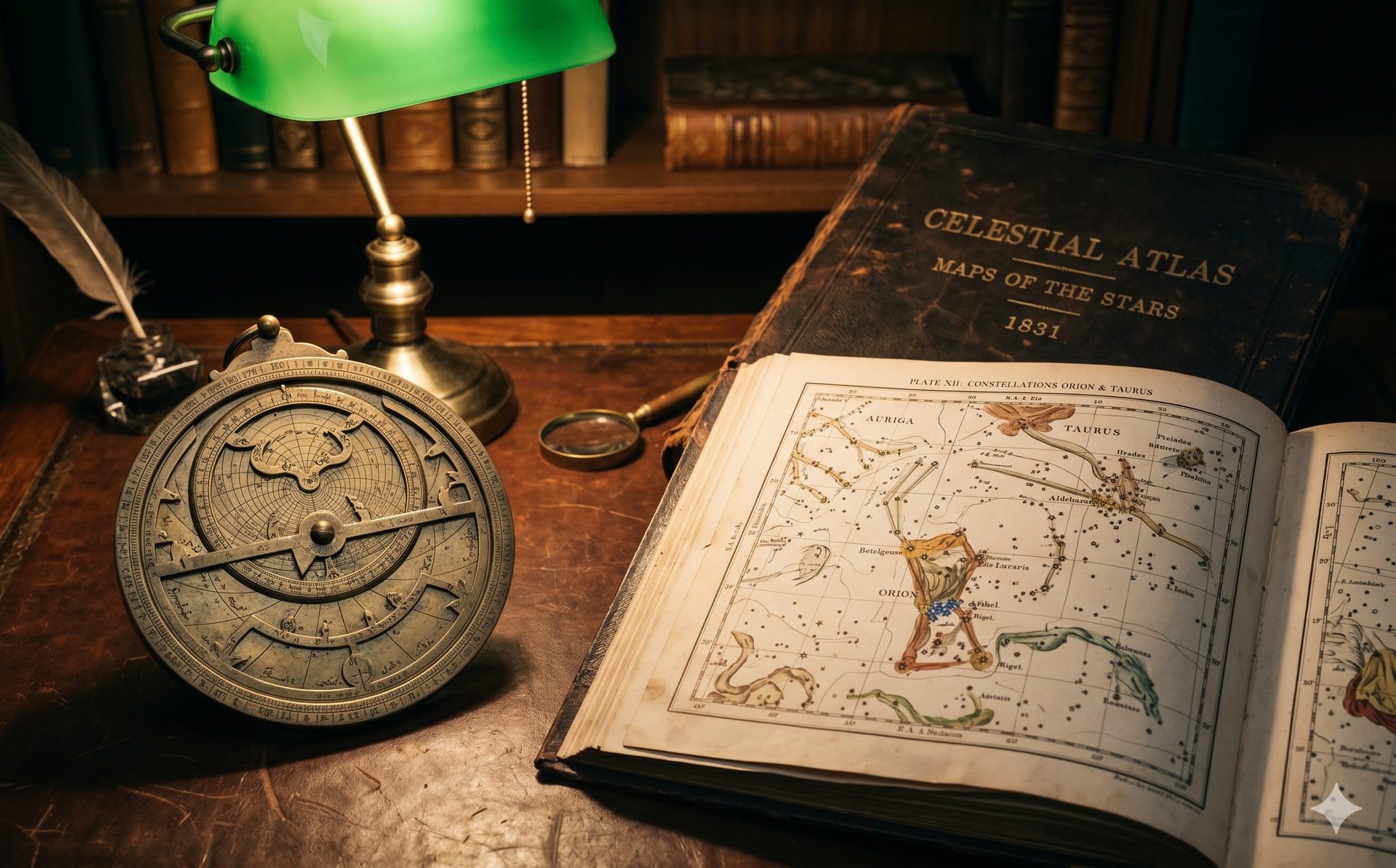
The Science Behind Our Star Maps: How Custom Celestial Charts Work
Every Stars In Hands print is powered by real astronomical data. Here's what's under the hood — from star catalogs to Milky Way rendering.
Read Article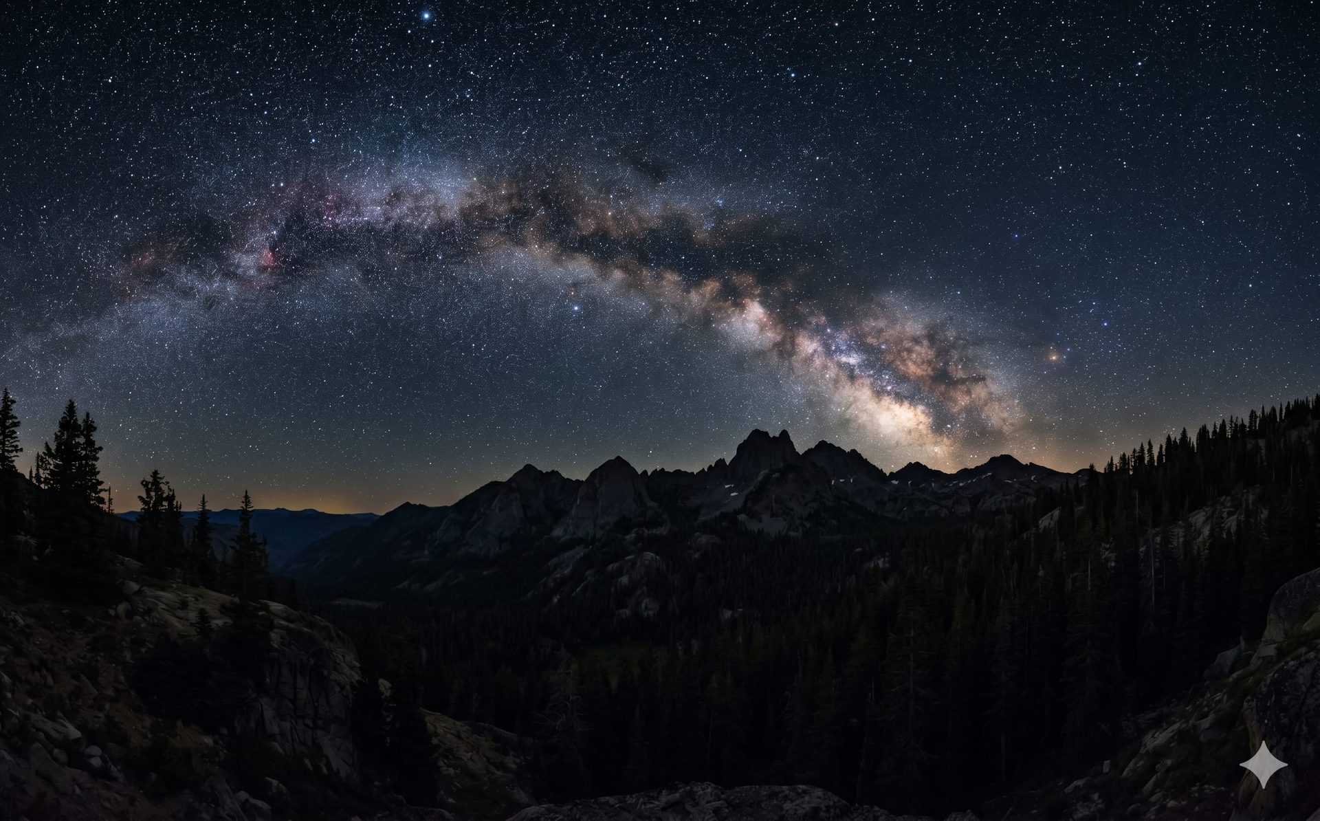
Understanding Constellations: A Beginner's Guide to the Night Sky
The night sky has told stories for thousands of years. Here are the 12 constellations every beginner should know — and how to find them tonight.
Read Article